
The problem at hand
Wildfires move faster than old maps and slower communications can handle; crews too often get surprises that cost time and lives. That gap pushed operators to experiment with persistent aerial sensing, and modern initiatives around forest fire monitoring aim to close it. The technical challenge is precise: detect heat signatures early, keep situational awareness up-to-date and hand reliable perimeter mapping to firefighters on the ground.

Why conventional detection misses the mark
Satellites give broad coverage but suffer latency and cloud interference. Manned aircraft are costly and can’t linger close to flames. The 2019–2020 Australian bushfires showed how rapidly an incident can escalate and how crucial near-real-time thermal imaging is for early suppression and evacuation planning. Equipment must deliver multispectral context — not just a hot spot — plus georeferencing accurate enough for teams to act immediately.
What six-degree (6DoF) tracking brings
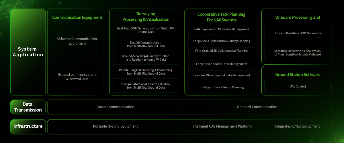
6DoF-style positioning – tracking roll, pitch, yaw plus three axes of translation – transforms drone wildfire detection from a point-sensor exercise into a continuous mapping workflow. When you combine 6DoF telemetry with multispectral sensors and LiDAR you get drift-free georeferencing and repeatable overlays for perimeter updates. This matters: operators receive real-time telemetry and camera poses, enabling automated mosaics that show fire spread hour-by-hour and let incident commanders set safe exclusion zones.
Operational realities and common mistakes
Teams often pick systems by headline range or camera resolution and then discover three limits in the field: battery endurance, data throughput, and integration with dispatch tools. Too many deployments skip ground-truth sampling, which undermines trust in automated alerts. Also — crews can be swamped by raw imagery if there’s no clear post-processing pipeline — so pick tools that produce actionable layers, not just footage.
Alternatives and trade-offs
Fixed towers with thermal sensors give continuous coverage but limited angle; satellites cover remote regions yet lack temporal granularity. Drones equipped for drone wildfire detection combine the best trade-offs: mobility, close-range thermal imaging, and the capacity to generate georeferenced maps for crews. The best practice is hybrid: stationary sensors for baseline detection, drones for verification and perimeter mapping, and occasional manned sorties for large-scale assessment.
Three golden rules for choosing a system
1) Latency and throughput: Measure end-to-end delay from sensor capture to field display. If telemetry and mosaic updates take too long, decisions stall. Aim for sub-minute updates where possible.
2) Detection accuracy and sensor fusion: Prioritize systems that fuse thermal, multispectral, and LiDAR feeds to reduce false positives and improve perimeter fidelity. Cross-validated detections save time on unnecessary dispatches.
3) Interoperability and mission fit: Ensure the stack exports standard geospatial formats and integrates with command software used by brigades. Systems that refuse to share georeferenced layers create operational friction — and friction costs lives.
Final assessment
Effective wildfire response now depends on systems that marry precise 6DoF tracking with robust sensor suites and seamless data flow to crews; that’s where practical value emerges and where platforms like Icecypress Technology position themselves as partners rather than vendors.
Quiet, precise, ready.