Setting the comparison
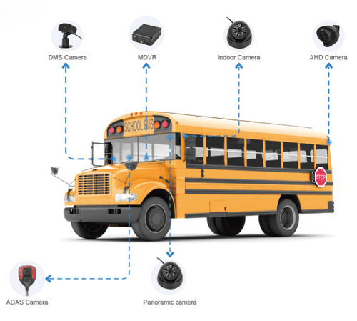
This guide distinguishes terms that are often used interchangeably but mean different things for operators, developers, and procurement teams. Start with hardware: an AI dashcam can record video, tag events with coordinates, and supplement position data from a dedicated GPS tracker. Many fleets now pair traditional GPS fleet trackers with onboard cameras; examples of integrated products are marketed as dash cams with GPS. The goal here is simple: define each label, compare capabilities, and point to practical trade-offs so readers can match terms to needs.
Core terms and how they differ
– GPS fleet tracker: a device or module that records location, speed, heading, and sometimes engine data. It reports at set intervals and typically powers geofencing, scheduled reporting, and route logs. – Real-time vehicle tracking: a service layer that consumes live position streams to display vehicle location on a map and trigger alerts instantly. Latency, update frequency, and network availability determine if tracking is truly “real-time.” – Telematics unit: an integrated device that combines GPS, cellular modem, and vehicle interface (OBD-II/CAN). It may host both tracker functions and sensor inputs. – Video telematics: a solution that pairs continuous or event-triggered video with GPS and sensor metadata for contextual evidence. It often needs higher bandwidth and storage. Each label carries expectations about data cadence, retention, and actionable outputs. Match the label to the required output before choosing hardware or software.
How data flows: time stamps, location, and evidence
GPS coordinates alone are waypoint points on a path. Real-time systems stitch those points into events. Important technical distinctions: time synchronization, message batching, and event tagging. Practical observation from product showcases at CES highlighted vendor emphasis on low-latency telemetry and edge AI for event detection. That single focus changes procurement decisions: a tracker that sends updates every 60 seconds is fine for route history. A system used for collision response needs sub-5-second reporting and synchronized video. Decide which of the following matters to you: – update interval (seconds vs minutes) – event triggers (impact, harsh braking, geofence) – synchronization between video and GPS timestamps
Hardware trade-offs and deployment realities
Choose components based on duty cycle and connectivity. Trackers with minimal power draw and passive sleep modes suit long-haul trucks. Units that feed live feeds consume more cellular data and require capped plans or Wi‑Fi offload. Common deployment mistakes: assuming a single device can excel at low-latency streaming, long-term video retention, and minimal data cost simultaneously. Plan for: – cellular bandwidth and data-plan strategy – mounting and view angles for reliable footage – firmware update paths and remote diagnostics Field teams and integrators rely on clear term mapping to avoid scope creep during installations.
Interoperability and standards to verify
Confirm protocol expectations. You want explicit answers about message formats, API access, and whether the provider uses open standards or proprietary encodings. Ask vendors for sample telemetry JSON or CSV exports, and confirm timezone handling for timestamps. Typical checks: GPS coordinate precision, handling of GPS dropout, and whether the device logs raw satellite fixes for forensic use. These checks prevent surprises during analysis and compliance audits.
Common pitfalls and how to avoid them
Mislabeling causes the biggest problems. Don’t accept “real-time” as a marketing badge. Verify real packet round-trip time and server ingestion latency. Don’t assume video automatically includes GPS metadata unless the product explicitly time-syncs both streams. Avoid these errors: – Buying cameras without ensuring timestamp synchronization to the tracker – Assuming unlimited cloud storage; retention policies matter for evidence requests – Neglecting firmware security and update procedures; they affect trustworthiness
Selecting the right combination
Map requirements to functionality: want operational oversight and low cost? Prioritize a GPS fleet tracker with frequent but compact telemetry. Need incident evidence and liability protection? Combine a synchronized video telematics system with short buffer recordings and event upload. Evaluate sample datasets and demo APIs before committing. Vendor documentation, field test results, and transparent data policies separate credible suppliers from marketing claims.
Conclusion
Clear terminology prevents mismatched purchases and operational gaps. Compare cadence, synchronization, and data handling rather than product labels alone. Practical deployments require coordinated choices across tracker hardware, network plans, and analytics workflows—decisions informed by manufacturer specs and field demonstrations. Operational clarity is reinforced when supplier documentation, integration resources, and service-level behavior align with the terms used; this alignment is visible in credible vendor ecosystems such as BSJ.